
|
||
|
Home | Spelletjes | Uitvindingen | Gps | Scouting | Meteo | Computers |
||
| Gps / Amsterdam Waypoints | Menu | |
Waypoints in AmsterdamDaniël Kropveld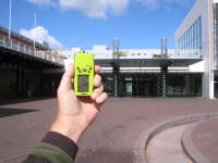 Waypoint Stopera Here you can find a set of waypoints, which you can use during your visit to Amsterdam.
Just upload them into your Gps, and then you always know where you are;
the exact place of the nearest museum, market or any object that an Amsterdam visitor might be interested in.
Signal strength in Amsterdam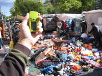 Waypoint Waterlooplein Signal strength may be problematic in the center of Amsterdam, with high buildings and narrow streets. My gps needs a long time to get synced, and when it does you are depending on just 2 or 3 satellites. Try to stay in contact, because the moment you lose signal, you will have to find an open spot and wait for many minutes to regain sync. And even then you may find that your position is dozens of meters off! Probably by reflections of the buildings. At one spot in the center of Amsterdam I measured an error of 150 meters! All the waypoints below are an average of al least two 'field' measurements and a final check on a calibrated map. I own a very minimalistic Garmin-Geko, but some readers informed me that other devices perform better.
The waypoints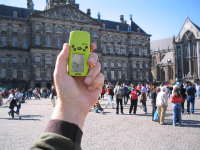 Waypoint Dam The waypoints are all collected on the site itself, and edited on a calibrated map of Amsterdam. Use at your own risk, and beware that your gps can be erratic in places where satellite reception is not ideal. Usage of the waypoints is free, but I would be very pleased if you'd send me a postcard after your return home. See below for the postcards I received so far, and imagine how it feels if yours was in it! Redistribution of the waypoints in terms of the
Creative Commons Licence ,
which means you are free to modify and redistribute the set, provided you do it for free and mention this site
(www.kropveld.net), using the same CC-Licence.
How to use Waypoint Leidseplein After you downloaded the waypoints file, you upload it into your Gps. The file is in gpx-format, which is supported in most gps-applications. If your software does not support the gpx-format, there are two things you can do: You can use another program that will handle gpx-format, or convert the gpx-format into something that your software will read. Links to that software you will find at the very bottom of this page. There is also a kml-version available that you can import into Google Earth. To summarize, here is what you should do:
Latest VersionLatest version is completely revised and corrected, with Garmin waypoints included: April 2010. New waypoints will be added as soon as I start receiving postcards again! DownloadThe waypoint-set is available in xml (gpx) format, which is considered as a universal gps-standard.
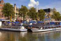
Free Garmin Map Waypoint Vondelpark If you have a Garmin Gps that supports street-maps ('x'-model), you can download a Netherlands street map which you can use in combination with your waypoints. The map is free (free as beer and free in speech) and part of the OpenStreetmap project. It is very detailed and accurate, and support navigation! I recommend using this map together with my waypoints. A daily build of the Garmin image of the Netherlands OpenStreetmap project is downloadable here. Enjoy your stay in Amsterdam! Please send me your postcard and comments
Postcards received Ken, Destin Florida (US)
Hello Daniel,  Erik en Loes, Nijmegen NL
Superhandig, je gps-punten in Amsterdam.
Het is alweer een tijdje geleden dat we ze gedownload hebben, maar een kaartje zijn we niet vergeten.
 Daniel Kimpara, Wageningen NL
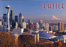 Mark Gnagy, Seattle Washington, USA
Thanks for the GPS waypoints for Amsterdam. I found them to be very helpful during my recent trip.
I used a Garmin Etrex Vista Hcx and had good luck keeping sat lock.
 Ricky, Antwerpen, BE
 Larry Chow, Burnaby, CA
This is a view of the city looking in a S.E. direction.
I actually live in Burnaby, a suburb of Vancouver and you can see some buildings in Burnaby on the horizon of the postcard.
The picture was taken on a clear day bcause you can see Mt Baker which in in the United States.
This is a rareity bacause traffic in our region produces quite some smog.
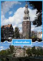 C. Kempenaar, Amsterdam NL
 Fan Feizhou, Beijing, CN
The Temple of Heaven is a worthwhile visiting place in Beijing.
It is much bigger than the Forbidden City and smaller than the Summer Palace with an area of about 2,700,000 square meters.
The Temple was built in 1420 A.D. during the Ming Dynasty to offer sacrifice to Heaven.
As Chinese emperors called themselves "The Son of Heaven", they dared not to build their own dwelling,
"Forbidden City" bigger than a dwelling for Heaven. (...)
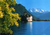 J. Corniche, Lausanne, CH
 Ton Gudde, Den Helder, NL
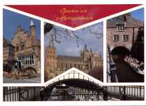 Nico Koppers, 's Hertogenbosch, NL
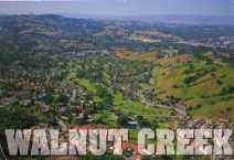 Rick Enriquez, Walnut Creek California, USA
It took a little while because I wanted to send a Walnut Creek postcard and I could not find it right away.
 Delmer Johnson, Denver Colorado, USA
External Links
|
Departementen Gps artikelen |
|
| Top | Bekijk | Afdrukken | Zoek Pagina gewijzigd op 02 februari 2021 om 11:46 | ||
